Using the tsunami source model for the recent earthquake, we have calculated the height of the tsunami when it reached the coastline. (note: the source model is subject to change)
Note:
For the Fukushima(South) simulation, the water level was adjusted to 70% of the original, reflecting the actual data obtained from the field study. Further research is conducted to identify the details regarding the borders of Northern and Southern Fukushima.
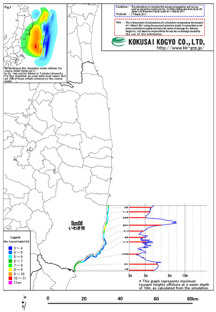 Tsunami Height Distribution Map