One of key challenges in the transition from a rescue to a recovery phase is how to clean up all the debris scattered across the affected area. As vast amount of debris is spread across a wide area, the data on the spread of the debris as well as the ability to monitor the removal process becomes crucial for an organized and efficient removal initiative. The following shows the spread of the debris (shown in red) using the image taken by the super high resolution GeoEye-1 which was put through an image processing technique. Keeping a regular record of this allows for an accurate and efficient effort to clean up the debris.
☆Spread of timber debris in Rikuzen-takata
oward Sound Recovery: Monitoring of Debris Distribution using High-resolution Satellite Imagery
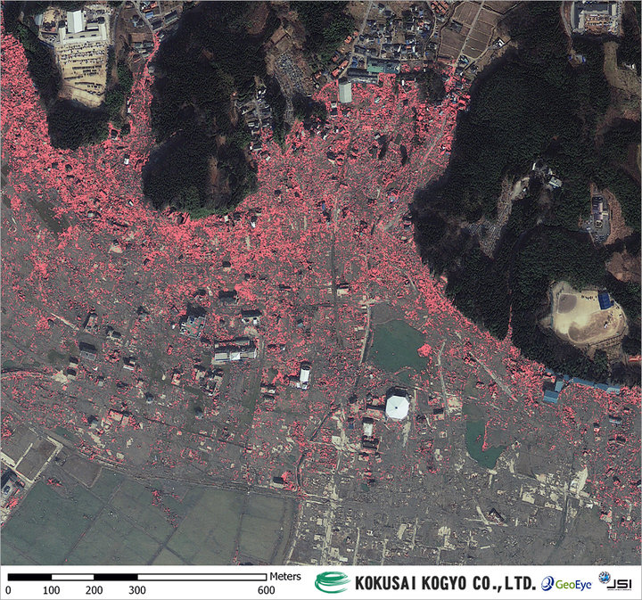 patial resolution of 50cm; March 13, 2011