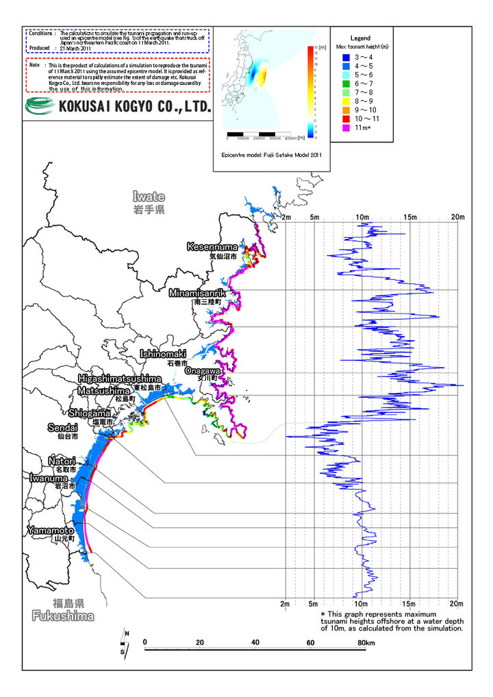
Using the tsunami source model for the recent earthquake, we have calculated the height of the tsunami when it reached the coastline. (note: the source model is subject to change)
 Inundation maps