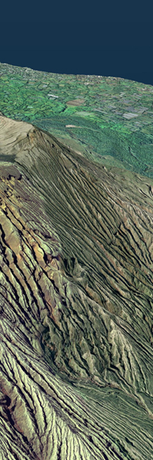
Using the tsunami source model for the recent earthquake, we have calculated how far the tsunami extended beyond the coastline. (note: the source model used is subject to change)
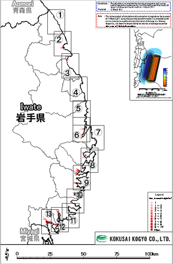 Inundation maps
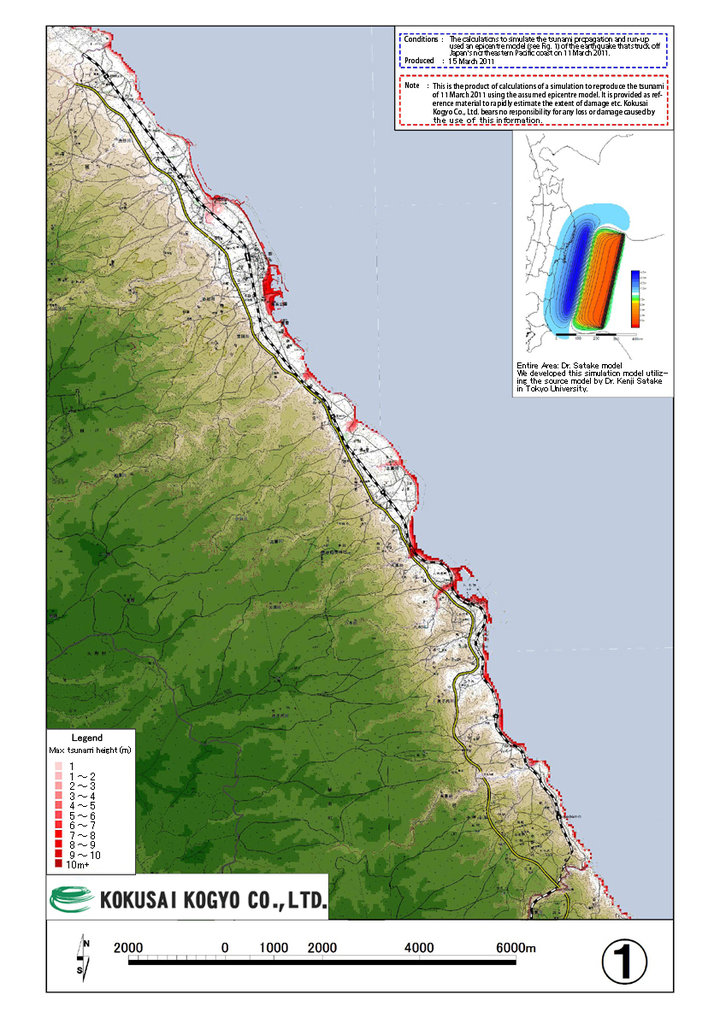 1. Hirono-Cho
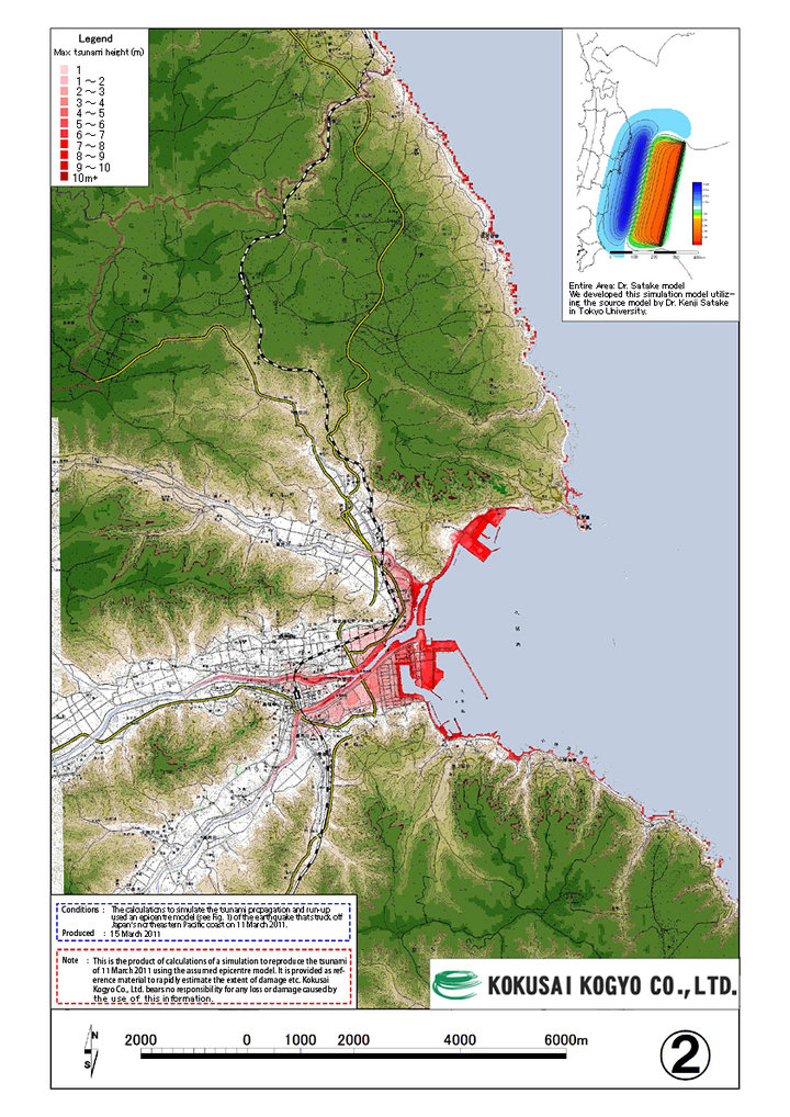 2. Kuji City
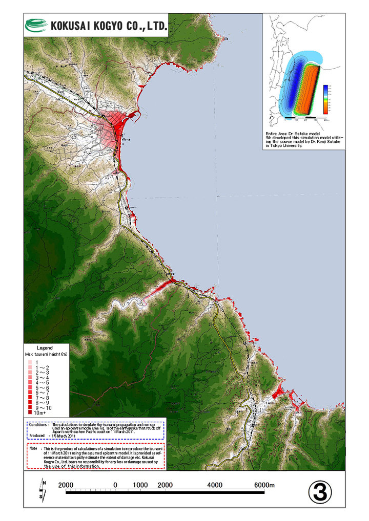 3. Noda Village, Fudai Village
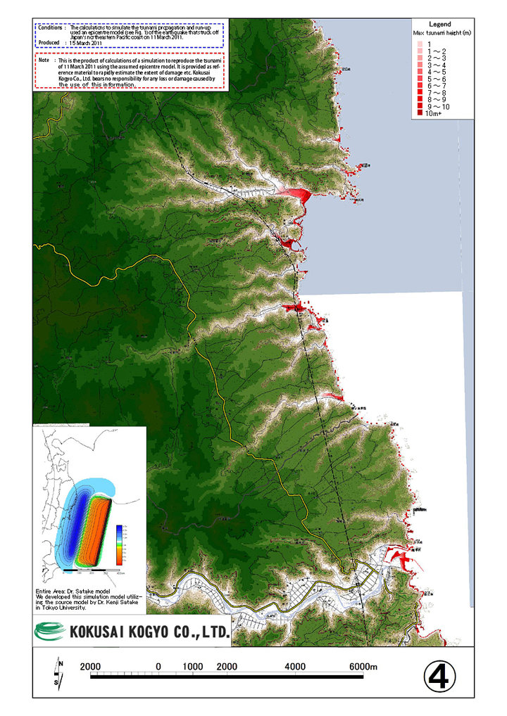 4. Tanohata Village, Iwaizumi-cho
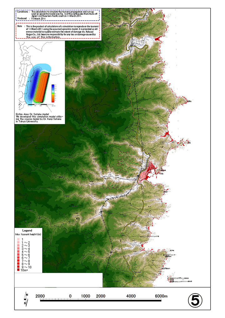 5. Miyako(Taro)
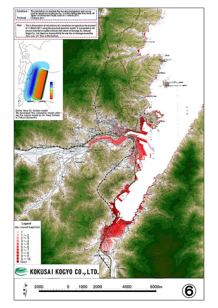 6. Miyako(Miyako)
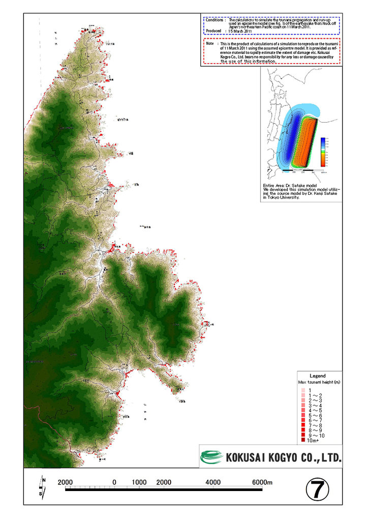 7. Miyako (Todogasaki)
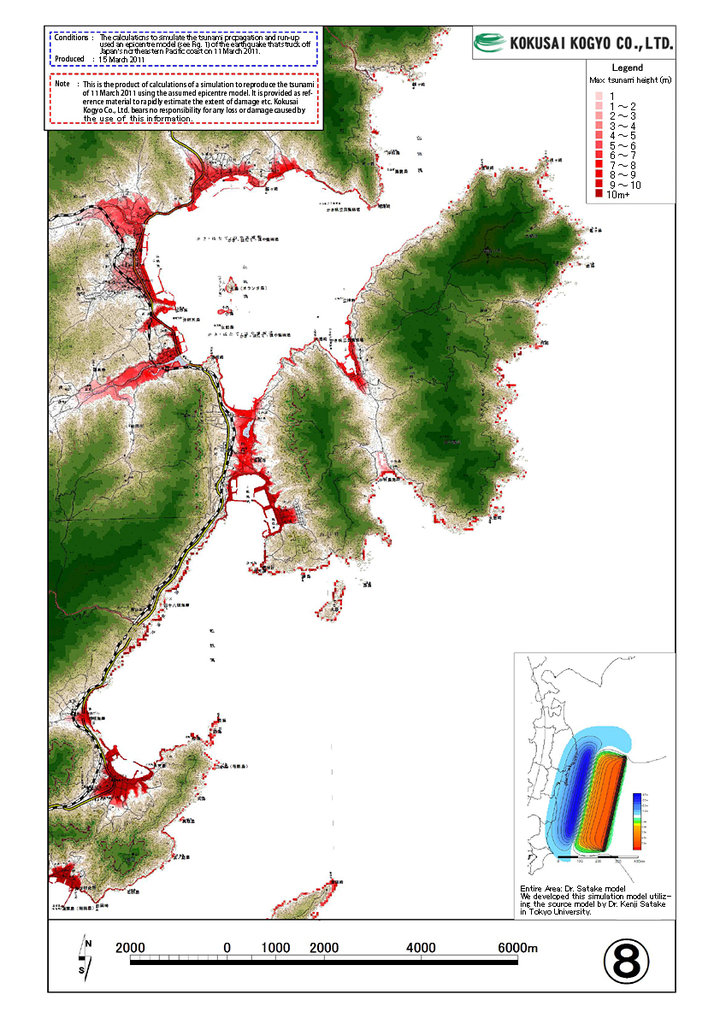 8. Yamada-cho
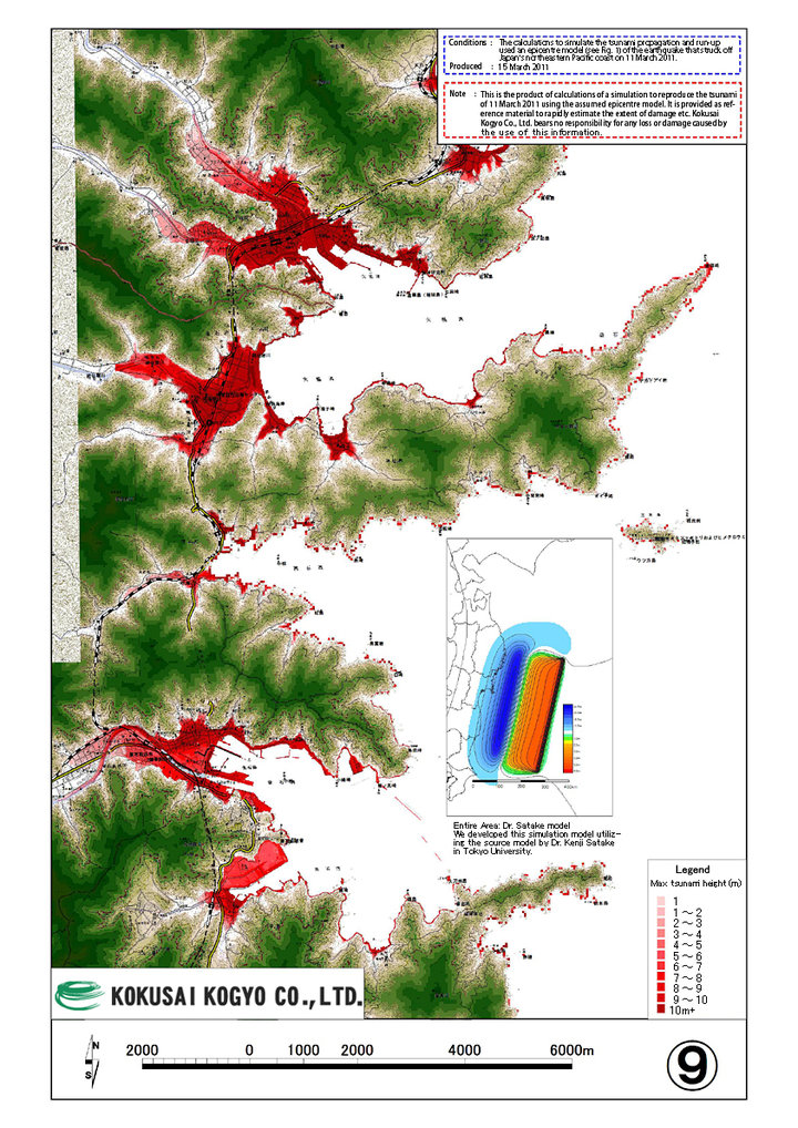 9. Otsuchi-cho, Kamaishi City
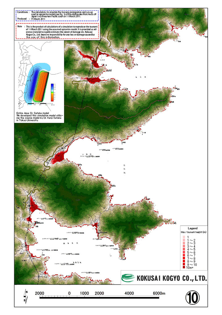 10. Kamaishi City, Ofunato
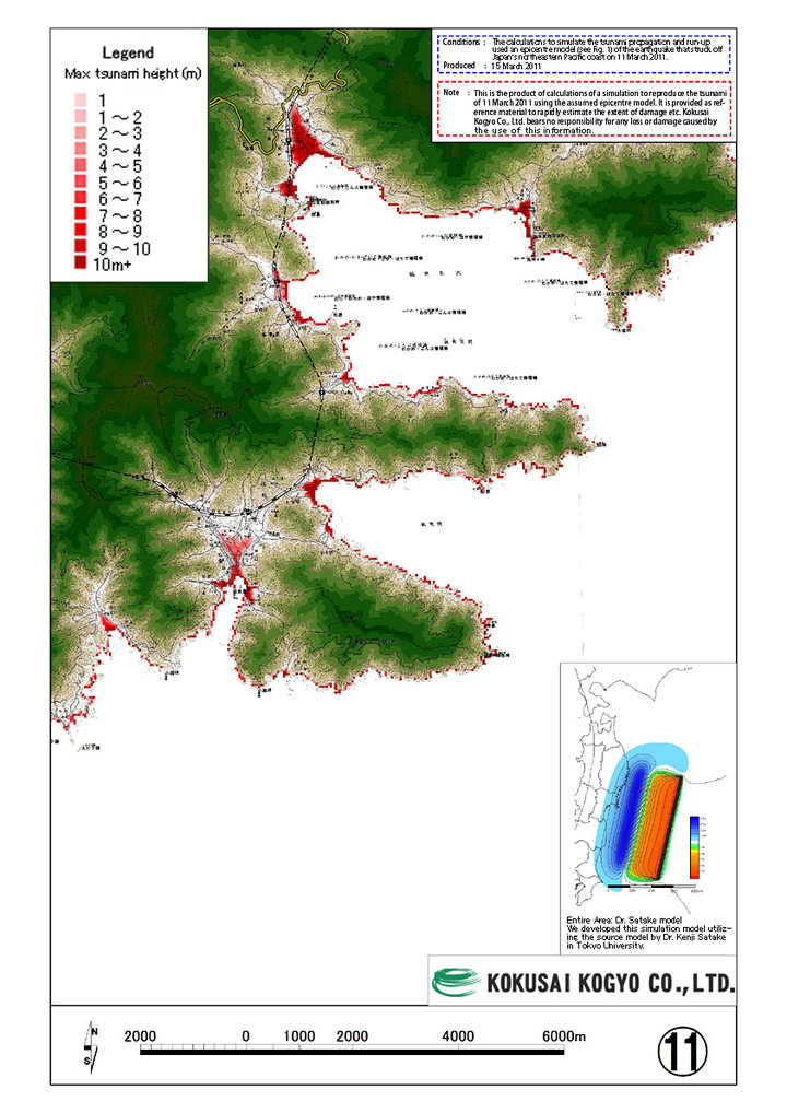 11. Ofunato
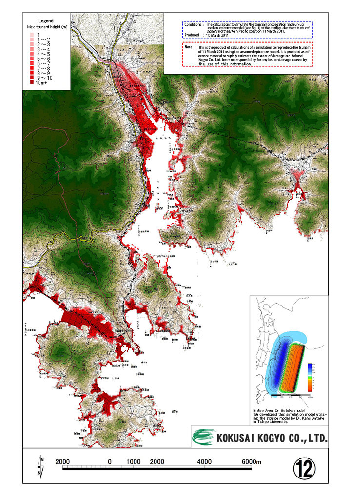 12. Ofunato
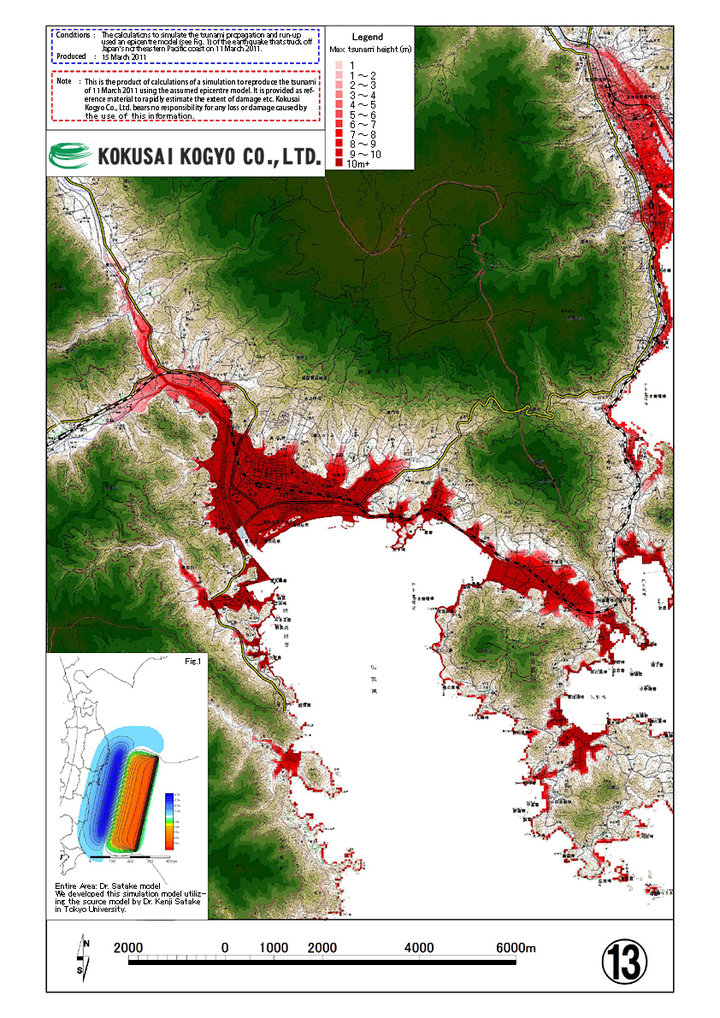 13. Rikuzen-takata City