This image, taken at 10:34 on March 12, shows how far the tsunami has reach in Soma city, Fukushima. The extent of the inundation caused by the tsunami is shown on the satellite image on the right while the left shows the same but on a topographic map.
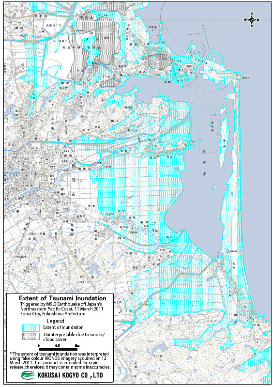 Preliminary map showing the reach of tsunami near Soma City
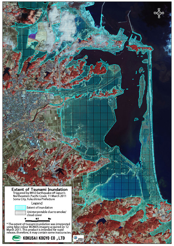 Preliminary map showing the reach of tsunami near Soma City