Littoral forests play a vital role in disaster prevention by providing protection against wind, sand, and sea water. However, during the last Quake, much of the littoral forest was wiped away by the tsunami. A critical part in reinstating the littoral forest is the damage assessment. The following uses the pre- and post-quake imagery taken by super high resolution satellite, GeoEye-1 and IKONOS to show the parts of the littoral forest and surrounding plants (in yellow) which were wiped away by the tsunami.
☆Rikuzen-takata littoral forest: pre-quake/post-quake/diminished forest & plants
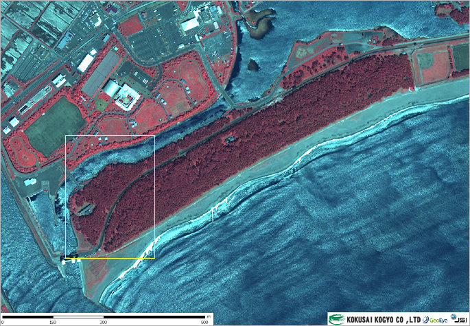 Study on the condition of littoral forests before and after the tsunami using high resolution satellite imagery
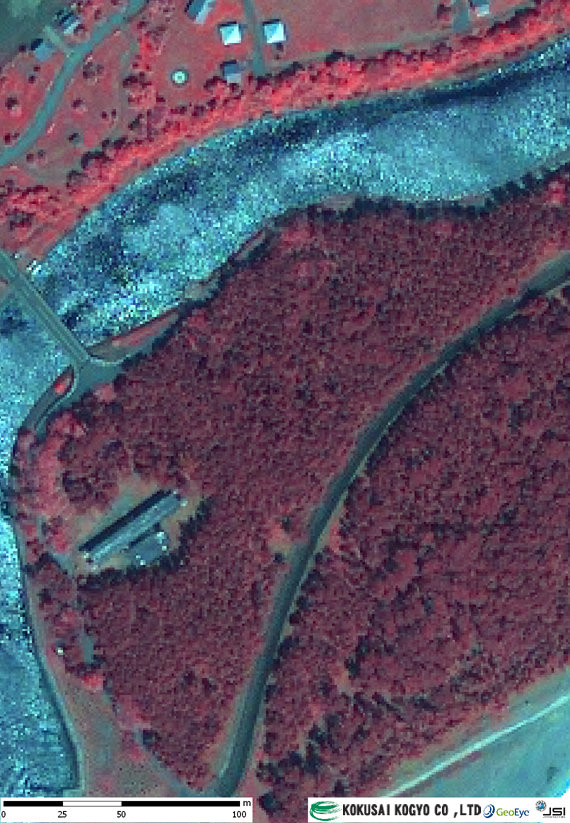 Study on the condition of littoral forests before and after the tsunami using high resolution satellite imagery
 Study on the condition of littoral forests before and after the tsunami using high resolution satellite imagery
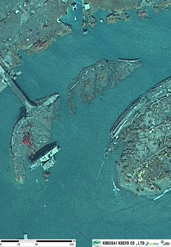 Study on the condition of littoral forests before and after the tsunami using high resolution satellite imagery
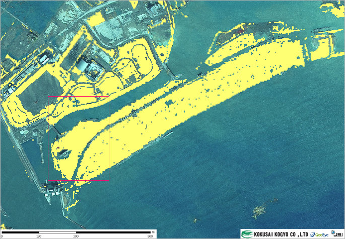 Study on the condition of littoral forests before and after the tsunami using high resolution satellite imagery
☆Soma city: Pre-/Post-/Diminished parts of the littoral forest
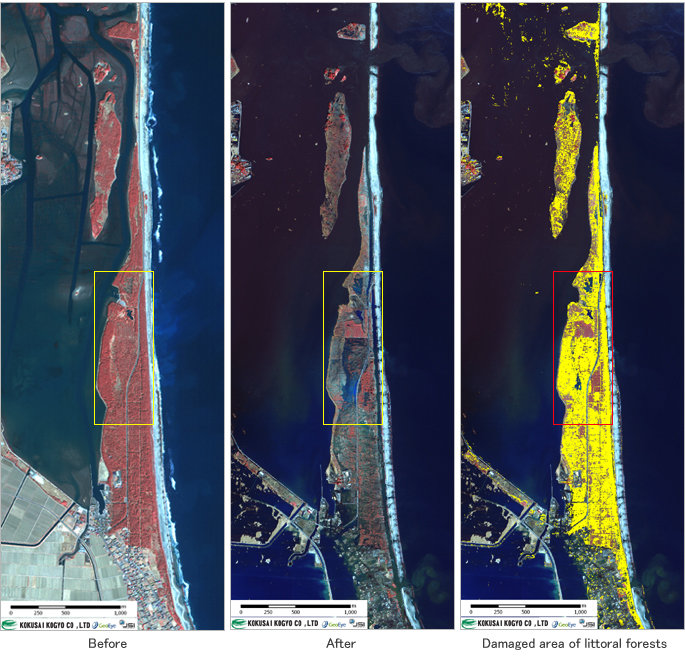 Pre-quake: spatial resolution of 1m; March 9, 2008
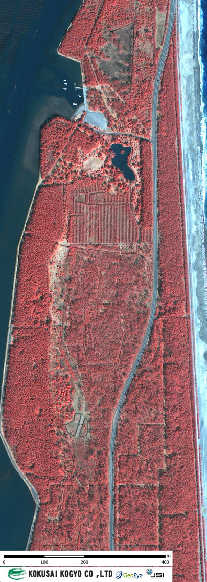 Before: March 9, 2008; spatial resolution of 1 m
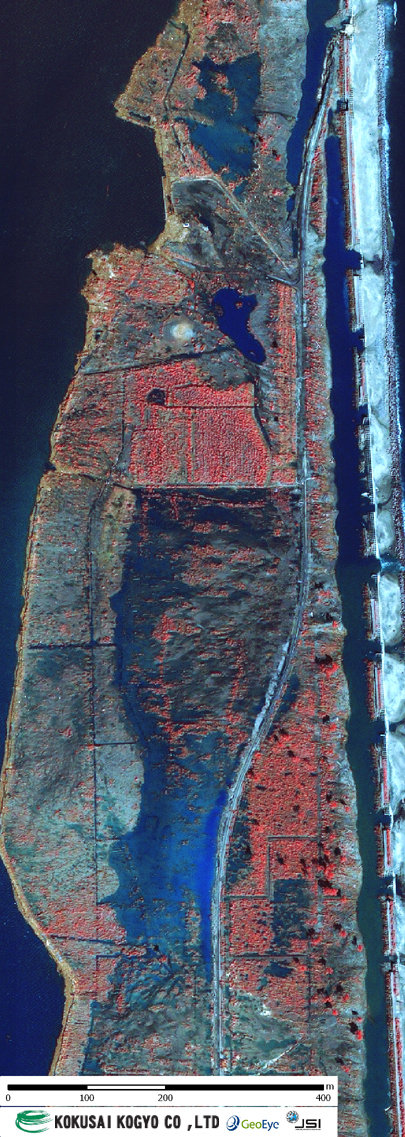 After: March 12, 2011; spatial resolution of 1 m
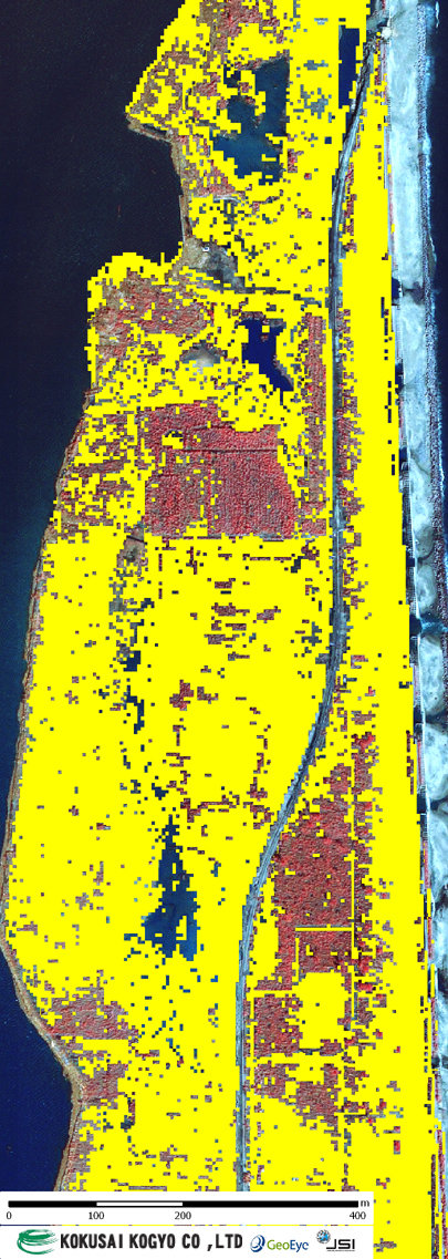 Damaged area of littoral forests